Posts

Hike to Buster and Azure Lakes

Image
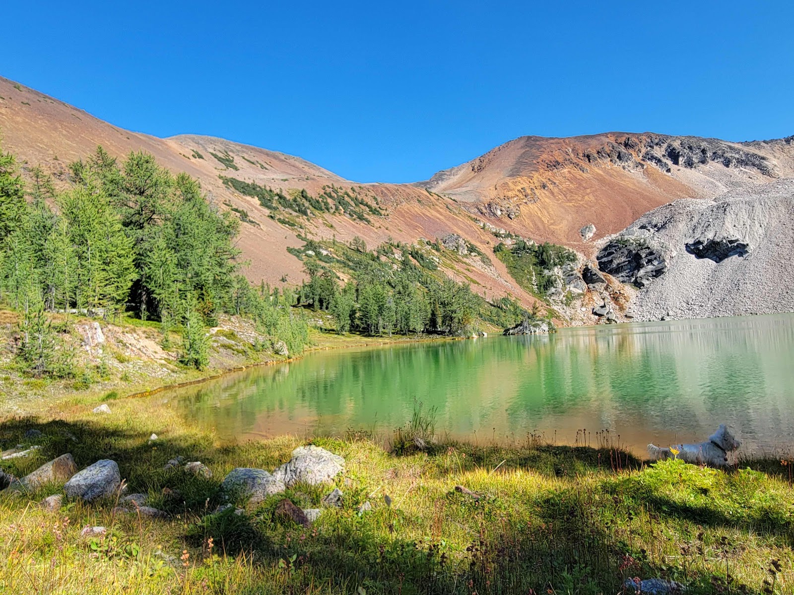
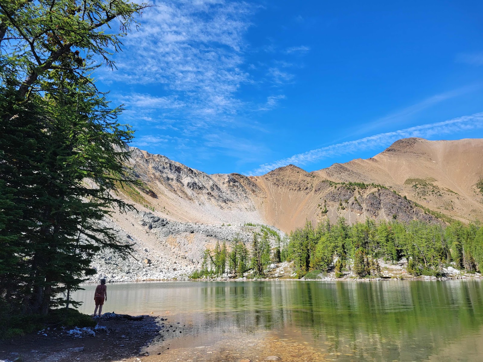
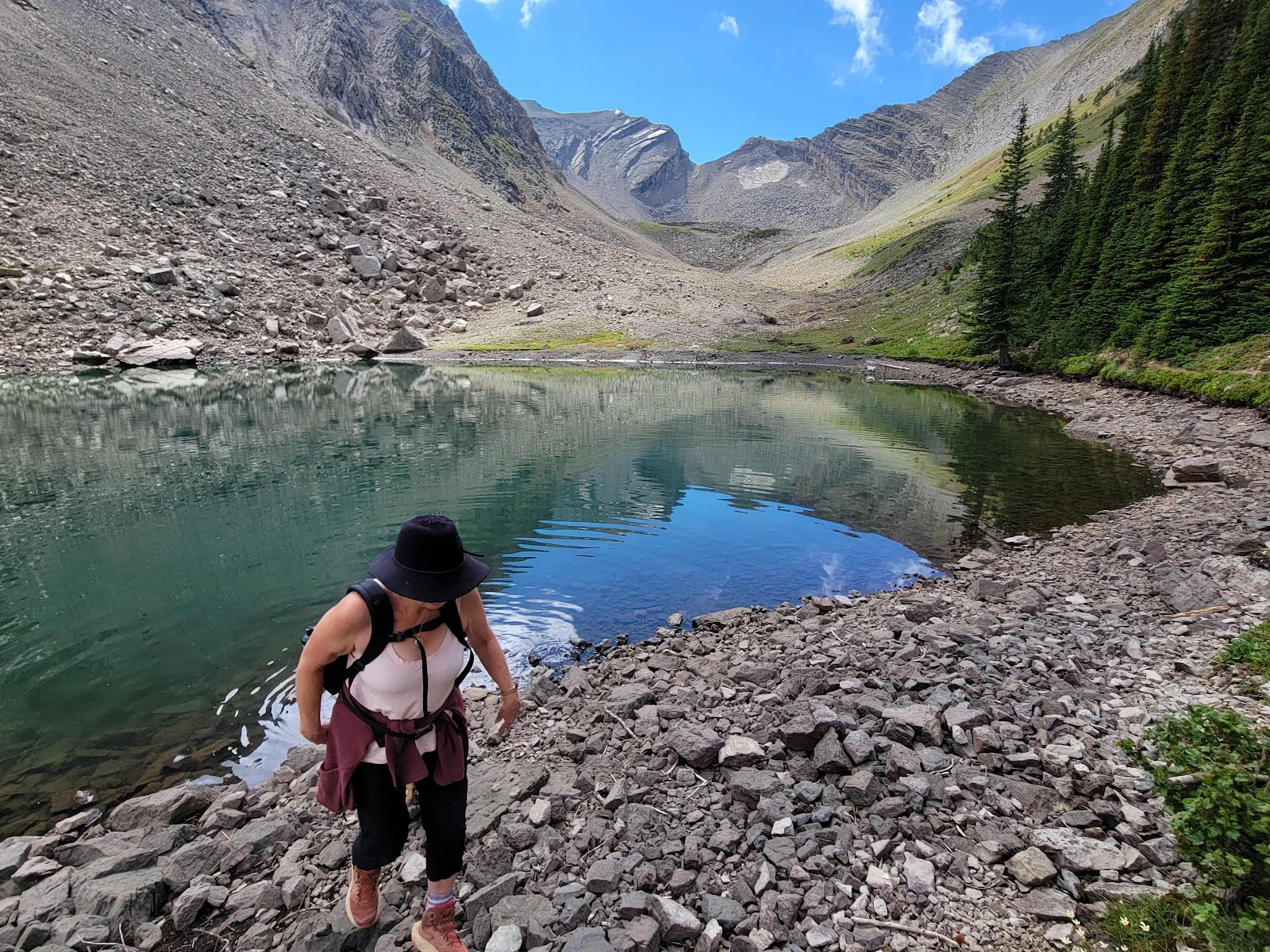
 13.2 km - 772 metre elevation gain  Beautiful hike that included a couple of hour drive across gravel and rock to trail head. The first bit's mainly through forest with relatively steep upward climb. Fir needles on the path were slippery on the path down. As well, we passed a wasp nest located on the forest floor and were both stung by wasps. Warned three couples and a group of girls with a guy whom I figured must be a dad. One from the group had already been stung. The trail emerges from the forest crossing a scee slope and then up another scree slope to the lake. The trail makers have done an excellent job of creating and marking a switchback trail up the scree. The lake as evidenced below was gorgeous. I suspect the green colour comes from the heavy iron content in the rocks. Finian produced evidence of such emerging from the lake covered in fine red dust. We stopped along the shore for a lunch of crackers and cheese with Newcastle Ale to wash it down. Finian and Pippa eac...

Brewer Lake and Upper Tarns

Image
Length - 12.7 km - Elevation Gain - 571 metres  Getting to this trailhead always causes me a bit of stress as the last two kilometres are very rough with large potholes and significant water bars such that navigation would be impossible without a high clearance vehicle (which we kinda have.) But, apart from the road to the trailhead, this trail is one of our favourites, partly because of the variety. The midway point is marked by a meadow with views up the valley to the mountains beyond. Then, it’s a steady climb to Brewer Lake which is surrounded on two sides by Brewer Peak and what they call Brewer NE2. We stopped for lunch at the lake while Pippa waited for scraps and Finny explored the lakeshore which is one of his most favourite activities. Nicola brought lunch and a beer to split which provided a relaxing interlude where we could sit back and enjoy the lake with its reflections of the surrounding peaks and Finny pawing at random objects he spots underneath the water.  Th...

Pedley Pass Tarn

Image
Distance - 7.22 kilometres - Elevation gain - 453 metres  This is one of our favourite walks. It’s short (about 3 hours) it has great views, and a lovely spot for a lunch and swim (if you happen to be very brave)  The walk begins with a steady climb to the bumpy meadows (which are bumpy) and then a steep stretch to a t-intersection. One path leads to Pedley Pass and the ridge and the other to the tarn which takes about half an hour but always seems longer to me. (The “we’re almost there syndrome”).  The weather was warm, the walk not too rigorous and the views terrific. 

Diana Lake - August 23, 2024

Image
17.91 km - 934 elevation gain - 7.43 km. - 7.75 hours  We began the trip by using Google to get to the trailhead, getting lost, and leaving Conrad and Theresa waiting for an hour at the trailhead. That said, they quickly forgave us. The trail begins along the Pinnacle Creek and then climbs steadily through a Douglas Fir and Cedar forest above the creek only to meet it again at the bottom of an avalanche slope. Pippa floated in a pool while we all stopped for a drink and rest and admired the neon glow of the fireweed with the Purcells in the background.  After an approximate 700 metre elevation gain, we emerged in an alpine meadow scattered with scraggly larch that look amazing in the fall. The memory makes me this travelling across the world to walk through mountains may not be so necessary when we have these amazing vistas right on a doorstep. (With a little effort obviously.)  We stopped for lunch at a bench in memory of someone next to Diana Lake with the majestic Moun...

Ghost Rider Mountain Trail (Mount Hosmer) - August 9, 2024

Image
 7.9 kilometres - 899 metres elevation - 7 hours overall  Ghost Rider Mountain, also called Mount Hosmer is easily visible from the town of Fernie with the Ghost Rider and his daughter visible on a sunny day and at sunset. There's a legend behind that I have provided at the end.  I drove the nine miles up a dirt road with large pot holes and water bars slowly for fear of damaging the driver's side read axle any more than it is. A rattling sound can be heard when hitting any kind of a bump that I'm sure any mechanic could diagnose just by driving it.  The trail begins through thick undergrowth that's much more lush than what we have just the other side of the Rocky Mountain Ridge to the east and south. Through the avalanche chutes we passed thick strands of fireweed that Nicola would like to pick one day to make into jelly. The forest differs from our area as well with the usual fir trees but also cedar and white spruce. There's not a huge difference in annual rainfa...

Pedley Ridge Loop - August 2, 2024

Image
  We started off from the trailhead at 11:30 on a hot, smoky day. The dogs weren’t invited for a couple of reasons. First, they weren’t particularly well after getting booster shots two days previous. Second, they go nuts when the picas make their cheaping sounds among the rocks well above the treeline. The ridge is rocky and narrow with a considerable drop on one or both sides of the trail.  The trail to the ridge is a bit of a grunt with about a 600 metre elevation gain. Once there, it’s a spectacular walk across however watching your step is paramount. You don’t want to go tumbling down the slope. The views are spectacular however shortened a tad by the smoke. Considerable logging has been performed since we last visited about a year ago.  Oh yes, I forgot the horse flies. A considerable nuisance nevertheless, we did stop for lunch at the top.  Overall, an enjoyable hike that was a bit hot. 

Assiniboine Lake - June 29, 2024

Image
15.3 km. 518 m elevation gain  Relatively easy drive in. Driving north on High 93, we turned right at Settlers' Road, continued 37 kilometres to just before the mine where we turned right again and followed an old forestry road a few kilometres fording a stream and over two rickety bridges.  The hike follows the creek that drains from Assiniboine Lake. It begins with a steady uphill climb over a couple of timbre bridges, one over a raging creek. A steel cable runs the length that can be used as a handrail. The trail flattens to meadow/boggy plain that leads steadily up to the lake. On the way, we passed the trail to Lunette Lake which, on the previous hike, we explored before proceeding to Assiniboine. This time, we proceeded to Assiniboine.  Nicola counted 12 people we passed on the trail, two couples, two pairs of women, groups of three and four and a couple of single guys, one carrying a sophisticated camera Nicola commented on. At the lake, we met up with a young guy ...